
Instructions
- Attempt all the questions in the spaces provided.
-
- Describe any three characteristics of an age-sex pyramid. (3 mks)
- Identify two demerits of using a population pyramid in data representation. (2 mks)
-
- Explain four ways in which land is being rehabilitated in Kenya. (4 mks)
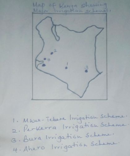
- Draw a map of Kenya and on it, locate the following;
- Mwea-tebere irrigation scheme
- PLerkerra irrigation scheme
- Bura irrigation scheme
- Ahero irrigation scheme (5 mks)
- Describe rice cultivation in Mwea-Tebere scheme under the following headings:-
- Harvesting (2 mks)
- Threshing (2 mks)
- Winnowing (3 mks)
-
- Give any three physical conditions that favour maize growing in Kenya. (3 mks)
- Apart from Trans-Nzoia county, name any other two counties where maize is grown on large scale in Kenya. (2 mks)
- Identify four characteristics of horticulture in Kenya. (4 mks)
-
- Describe how trawling method is used to catch fish. (5 mks)
- List five methods used to preserve fish. (5 mks)
- Why should the government of Kenya encourage fish farming? (5 mks)
-
- Give five tourist attractions found at the coast of Kenya . (5 mks)
- State five factors which influence the distribution of wildlife in East Africa. (5 mks)
- Your Geography class carried out a field study on wildlife in Lake Nakuru National Park.
- State five methods the class may have used to gather data. (5 mks)
- During the field study, the class collected data on the number of tourists visiting the Game part state five methods the class may have used to present data. (5 mks)
-
- Name three exotic dairy cattle breeds reared in Kenya. (3 mks)
- Explain three human factors that favour dairy farming in the Kenyan highlands. (6 mks)
-
- Explain how hydraulic action causes coastal erosion through the following:-
- Water hitting against rocks. (2 mks)
- Water pushing air in cracks. (4 mks)
- Name four features of wave erision at the caost. (4 mks)
- Describe the formation of a ria coast. (5 mks)
- Explain how hydraulic action causes coastal erosion through the following:-
-
- Describe the stages of land reclamation in the Netherlands. (6 mks)
- State four uses of polderlands in the Netherlands. (4 mks)

MARKING SCHEME
-
- Describe any three characteristics of an age-sex pyramid. (3 mks)
- Has a title
- Represents the age, sex and structure of a population
- Males are represented on the left while the females are on the right.
- The vertical axis shows the age-groups/cohorts
- The horizontal axis shows the population in numbers/percentages
- The length of the bars is determined by either the number of people in a certain agegroup or the percentage contribution to the population.
- Identify two demerits of using a population pyramid in data representation. (2 mks)
- It is difficult to draw
- It is not possible to tell the exact numbers represented at a glance as they are given as percentages/given as per the chosen scale.
- The data represented can only make sense after analysis and interpretation.
- Describe any three characteristics of an age-sex pyramid. (3 mks)
-
- Explain four ways in which land is being rehabilitated in Kenya. (4 mks)
- By filling open pits/quarries in order to be used for farming/settlement
- By construction terraces thereby reducing the speed of surface run-off/soil erosion.
- By planting trees on damaged land, thereby protecting it against the agents of erosion
- By building dykes along river banks/dams across rivers inorder to control floods
- By applying manures on degraded land in order to restore its fertility.
- By mulching/growing cover crops to retain moisture
- By controlling grazing to allow regeneration of pasture/control erosion.
- Draw a map of Kenya and on it, locate the following;
- Mwea-Tebere irrigation scheme
- Perkerra irrigation scheme
- Bura irrigation scheme
- Ahero irrigation scheme (5 mks)
- Describe rice cultivation in Mwea-Tebere scheme under the following headings:-
- Harvesting (2 mks)
- The rice is mature after about 5 ½ months
- The fields are drained to allow ripening
- Harvesting is done by hand using sickles
- The rice is then dried in the sun
- Threshing (2 mks)
- When the stalks are completely dry, they are threshed
- The threshing is done manually by hitting the paddy against the ground
- The grains are separated from the stalk.
- Winnowing (3 mks)
- Involves removing of the chaff from the gain
- Done by pouring the rice from a height to a large mat spread on the ground.
- Done on a windy day
- The heavier paddy falls on the mat while the light materials are blown away.
- The paddy is then taken to the mill.
- Harvesting (2 mks)
- Explain four ways in which land is being rehabilitated in Kenya. (4 mks)
-
- Give any three physical conditions that favour maize growing in Kenya. (3 mks)
- Moderate temperature/18°C – 27°C
- Moderate rainfall/600-1100mm for optimum growth
- Deep, well drained volcanic soils
- Undulating terrain
- Apart from Trans-Nzoia county, name any other two counties where maize is grown on large scale in Kenya. (2 mks)
- Narok
- Nakuru
- Uasin Gishu
- Bungoma
- Kakamega
- Identify four characteristics of horticulture in Kenya. (4 mks)
- The farms are mainly small
- The land is intensively cultivated to maximize production
- Advanced scientific techniques of crop production are used to ensure high yields
- It is labour intensive
- The products are mainly for sale
- Mainly practiced near urban areas.
- Give any three physical conditions that favour maize growing in Kenya. (3 mks)
-
- Describe how trawling method is used to catch fish. (5 mks)
- A bag shaped/trawl net is attached to a ship/trawler
- The net is cast into the water by the trawler
- The net’s mouth is kept open by otter boards.
- The upper part of the net is kept a float by corks/floats
- Weights are used to keep the lower part of the net at the sea bed
- The trawler drags the net along the sea bed.
- After sufficient fish has been caught, the net is hauled onto the trawler to empty the fish.
- List five methods used to preserve fish. (5 mks)
- Canning
- Freezing
- Smoking
- Salting
- Sun drying
- Why should the government of Kenya encourage fish farming? (5 mks)
- Fish farms occupy less space
- Fish supply proteins
- To create job opportunities
- Some fish from the farms are exported to earn foreign exchange
- May lead to the development of fish related industries
- It is free from international disputes
- Describe how trawling method is used to catch fish. (5 mks)
-
- Give five tourist attractions found at the coast of Kenya . (5 mks)
- Marine parks
- Historical sites
- Sandy beaches
- Water sports
- Hotels of international standards
- Terrestrial wildlife/parks
- Traditional culture
- State five factors which influence the distribution of wildlife in East Africa. (5 mks)
- The distribution/variation of vegetation influence the type of wild game found in an area
- The drainage of an area influences the distribution/population of different wildlife
- Human activities-conservation/destruction of wildlife habitats
- The soils of a place determine the plant life which influence the type of animals/birds found in a place
- The different types of climate influence the distribution of wildlife
- Relief/fairly level ground favours some animals while rugged terrain discourage them
- Change in altitude leads to variations in vegetation types/types of animals
- Your Geography class carried out a field study on wildlife in Lake Nakuru National Park.
- State five methods the class may have used to gather data. (5 mks)
- Administering questionnaires
- Interviewing/Asking questions
- Taking photographs
- Taking measurements
- Counting
- Content analysis
- Collecting samples
- During the field study, the class collected data on the number of tourists visiting the Game part state five methods the class may have used to present data.
- Drawing pie charts showing tourists from different countries
- Drawing tables
- Drawing graphs
- Drawing diagrams
- Oral presentation
- State five methods the class may have used to gather data. (5 mks)
- Give five tourist attractions found at the coast of Kenya . (5 mks)
-
- Name three exotic dairy cattle breeds reared in Kenya. (3 mks)
- Jersey
- Friesian
- Guernsey
- Ayrshire
- Brown Swiss
- Sahiwal
- Explain three human factors that favour dairy farming in the Kenyan highlands. (6 mks)
- The high population in region offers ready market for milk and other dairy products, thus favouring dairying
- There are milk processing factories which help in milk processing/storage, thus favouring dairying
- The region is served by good road network which enhances transportation of milk
- There is adequate provision of vet services which ensure the animals are in good health
- Farmers have formed co-op societies, enhancing procurement of inputs, credit and marketing of the produce.
- Name three exotic dairy cattle breeds reared in Kenya. (3 mks)
-
- Explain how hydraulic action causes coastal erosion through the following:-
- Water hitting against rocks. (2 mks)
- Water pushed by the waves hits the cliff face
- Since the water hits the rocks repeatedly, the rocks are loosened, disintegrating and falling into the sea.
- Water pushing air in cracks. (4 mks)
- Water is pushed into the cracks by the waves
- Air in the cracks is compressed increasing in volume
- Water withdraws and the air expands suddenly enlarging the cracks
- The process is repeated severally causing the weakening of the rocks along the cracks
- Eventually, the rocks break/disintegrate
- Water hitting against rocks. (2 mks)
- Name four features of wave erosion at the coast. (4 mks)
- Bays
- Headlands
- Caves
- Arches
- Stumps
- Stacks
- Blow holes/Gloups
- Geos
- Cliffs
- Describe the formation of a ria coast. (5 mks)
- River draining into the sea/ocean is submerged by sea water
- Occurs where the hills and a river valley meet the coastline more or less at right angle
- The entrance to the river valley is widened by the invading sea/ocean water
- A funnel shaped drowned river valley wider and deeper at the entrance than inland is formed.
- This is a ria coast.
- Explain how hydraulic action causes coastal erosion through the following:-
-
- Describe the stages of land reclamation in the Netherlands. (6 mks)
- Dykes are constructed to enclose part of the low-lying land covered by sea water.
- Ring canals are constructed on the interior sides
- Water is pumped into the ring canals using electric pumps
- Ditches are dug to drain excess water
- Drainage pipes are laid below the soil
- Chemicals are added to the soil reduce salinity
- Reeds are planted to drain the excess water
- Area is divided into regular portions using inner dykes and ring canals.
- Fresh water is pumped into the enclosed land to remove salt
- Pumping out of water from the polder is a continuous process to prevent water from accumulating again
- State four uses of polder lands in the Netherlands. (4 mks)
- Farming/crops and livestock
- Setting up recreational facilities
- Setting up settlements
- Industrial development
- Development of transport lines
- Tourist attractions.
- Describe the stages of land reclamation in the Netherlands. (6 mks)
Join our whatsapp group for latest updates
Tap Here to Download for 50/-
Get on WhatsApp for 50/-
Download Geography Questions and Answers - Form 4 Mid Term 1 Exams 2023.
Tap Here to Download for 50/-
Get on WhatsApp for 50/-
Why download?
- ✔ To read offline at any time.
- ✔ To Print at your convenience
- ✔ Share Easily with Friends / Students


